
Frenchmans Cap
Lyell Highway to the summit
About this map
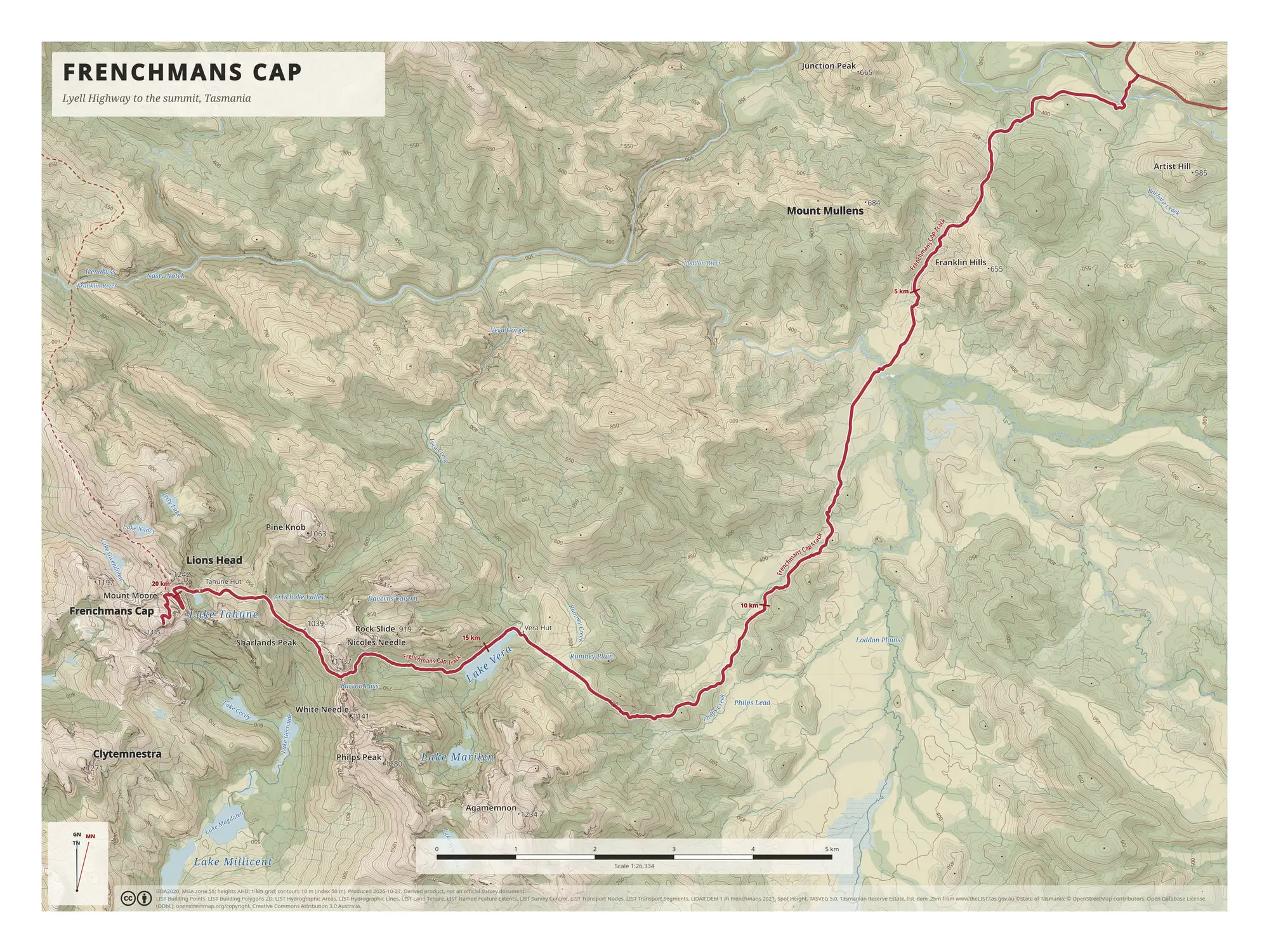
This poster follows the walk from the Lyell Highway, at the top right of the map, to the Frenchmans Cap summit area at lower left. The crimson route line is marked every 5 km, and the 20 km marker sits beside Lake Tahune.
Along the way the map names the creeks, plains, lakes and huts the route passes. It runs past Philps Creek and the open ground of Rumney Plain, reaches Lake Vera and Vera Hut near the 15 km marker, then continues over Barron Pass to Lake Tahune and Tahune Hut.
Around the route, 10 m contours (with a heavier line every 50 m) show the shape of the range: Lions Head, Mount Moore and Sharlands Peak beside the summit, Nicoles Needle and White Needle across the valley, and Clytemnestra, Philps Peak and Agamemnon to the south of Lake Vera, with Lake Marilyn and Lake Millicent below them.
The map is at 1:26,334 with a 1 km grid, and the scale bar along the bottom runs to 5 km.
On the map
- Vera Hut and Lake Vera
- Barron Pass
- Lake Tahune and Tahune Hut
- Route marked at 5 km intervals to 20 km
More maps
- kunanyi / Mount Wellington: Wellington Park
- The Overland Track: Cradle Mountain to Lake St Clair
- All maps