
kunanyi / Mount Wellington
Wellington Park
About this map
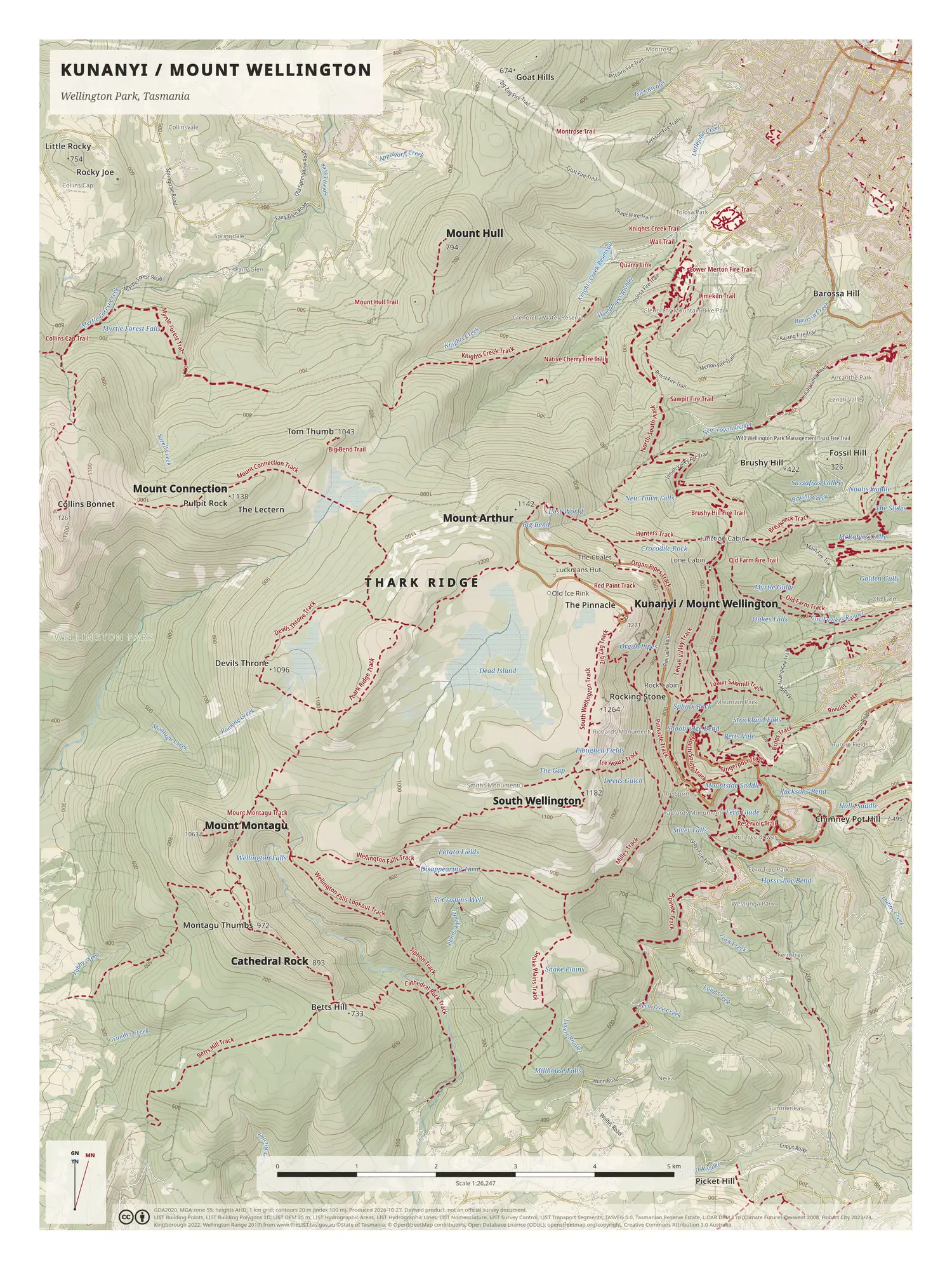
This poster covers Wellington Park. The Hobart suburbs fill the top right corner, and the park spreads out from there across kunanyi / Mount Wellington and the ridges and plateaus to its west.
The map is built around its tracks. Each one is drawn as a dashed crimson line and named along its length, so you can follow a single track from the suburbs up the mountain or across the park. At the centre is the Pinnacle, where the map prints a spot height of 1,271 m, and a road is marked climbing to it. West of the summit the Thark Ridge track runs along Thark Ridge, with Devils Throne beyond.
Other named peaks and features include Mount Arthur, South Wellington, Mount Montagu, Mount Connection and Cathedral Rock. Contours are at 20 m, with a heavier line every 100 m, at a scale of 1:26,247 and a 1 km grid.
On the map
- Thark Ridge and Devils Throne
- The Pinnacle and the road that climbs to it
- Mount Arthur, South Wellington and Mount Montagu
- Tracks down to the Hobart suburbs
More maps
- Frenchmans Cap: Lyell Highway to the summit
- The Overland Track: Cradle Mountain to Lake St Clair
- All maps