
The Overland Track
Cradle Mountain to Lake St Clair
About this map
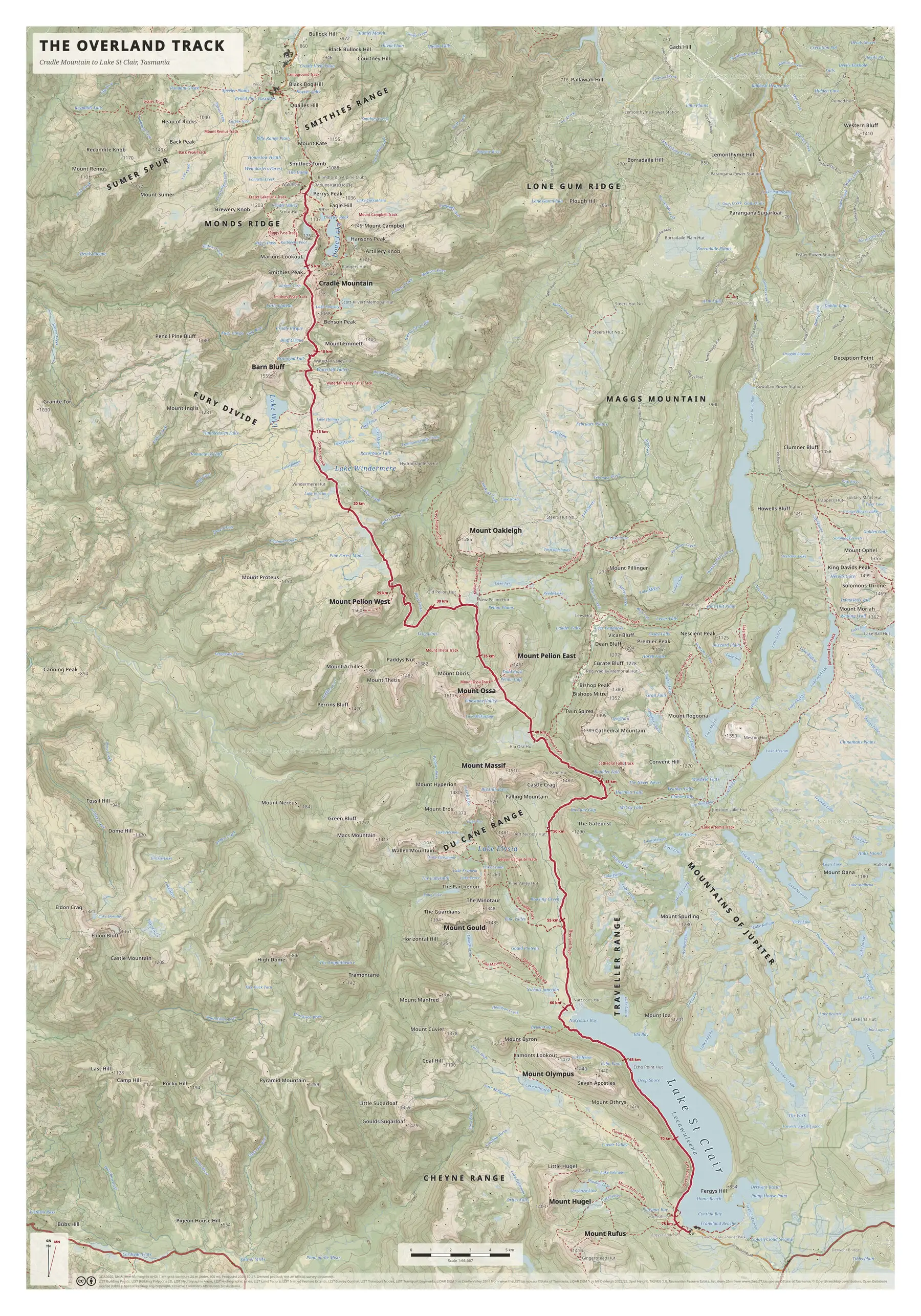
This is a large poster, 70 × 100 cm, covering the whole route from Cradle Mountain at the top of the map to Leeawuleena / Lake St Clair at the bottom. The crimson route line is marked every 5 km and reaches 75 km at the southern end of the lake.
The huts printed along the route include Waterfall Valley, Windermere, New Pelion, Kia Ora, Du Cane, Bert Nichols, Narcissus and Echo Point. Beyond them the map names the country on either side: Barn Bluff and Cradle Mountain in the north, Mount Pelion West and Mount Pelion East in the middle, and Mount Ossa, marked at 1,617 m, to the west of the route near the 40 km marker. Further south are the Du Cane Range, the Traveller Range and the long arm of Lake St Clair.
Contours are at 20 m, with a heavier line every 100 m, at a scale of 1:66,667 and a 1 km grid. Side tracks to named peaks, lakes and falls are drawn as thinner dashed lines.
On the map
- Cradle Mountain and Barn Bluff
- Mount Ossa and the Du Cane Range
- Huts from Waterfall Valley to Echo Point
- Narcissus Hut and Leeawuleena / Lake St Clair
- Route marked at 5 km intervals to 75 km
More maps
- Frenchmans Cap: Lyell Highway to the summit
- kunanyi / Mount Wellington: Wellington Park
- All maps